
Get the equipment and the crew to the site.
Mobilize is the logistics side of Barrio Grid. It shows where workers live and where crews can stay, how rail, trucks and barges already move freight around a site, and how a heavy load gets there from the port: the route, the bridges to check, and truck, rail and barge side by side.
How to use every Mobilize tool
Each chapter of the video above, in the order you would use it. Click a chapter to jump to it.
- Pro
0:04 Mobilize: the freight map
One click switches to a light basemap with county lines, roads by class, rail, ports and terminals, waterways, airports and crew lodging.
- Pro
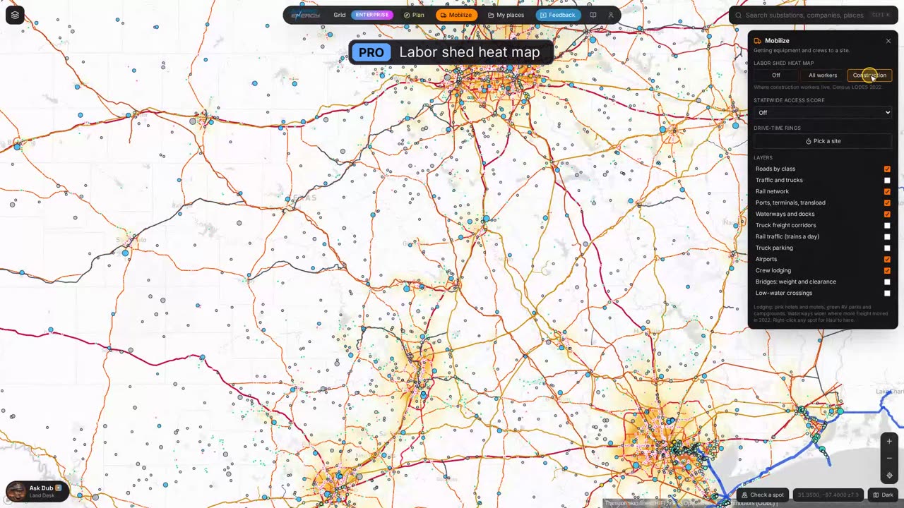
0:14 Labor shed heat map
Where workers live, statewide, or only the people who work in construction. Census LODES data.
- Pro
0:27 Crew lodging
Hotels and motels in pink, RV parks and campgrounds in green, from OpenStreetMap.
- Pro
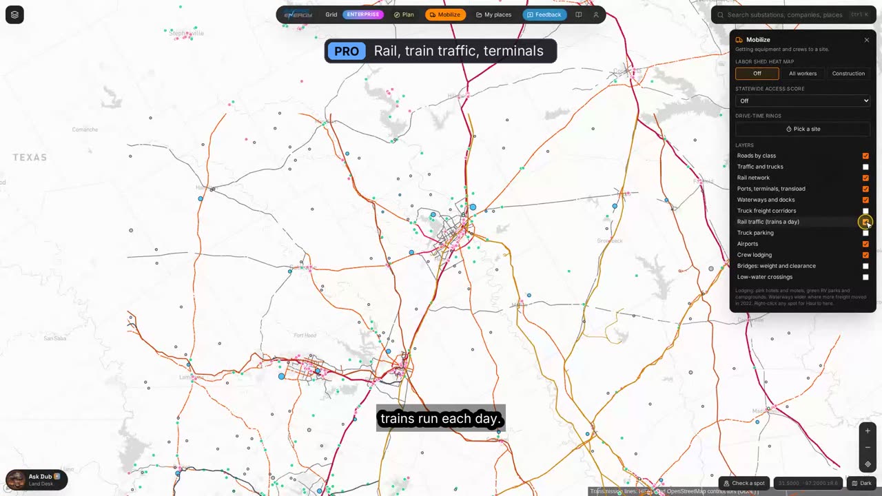
0:35 Rail, train traffic and terminals
Rail lines by railroad with spurs and sidings, freight trains a day on each line, and the transload and intermodal terminals where rail freight comes off onto trucks.
- Pro
0:49 Truck corridors and parking
Where heavy truck freight already moves, from the federal Freight Analysis Framework, and public truck parking with space counts.
- Pro
0:59 Waterways and docks
Barge channels drawn by tonnage, with the docks along them.
- Pro
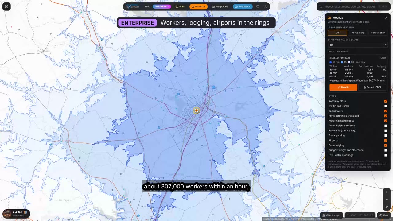
1:12 Drive-time rings
Pick any spot for 30, 45 and 60 minute drive areas.
- Enterprise
1:20 Workers, lodging and airports in the rings
How many workers and construction workers live inside each ring, how much lodging is there, and the nearest airline airports with drive times.
- Enterprise
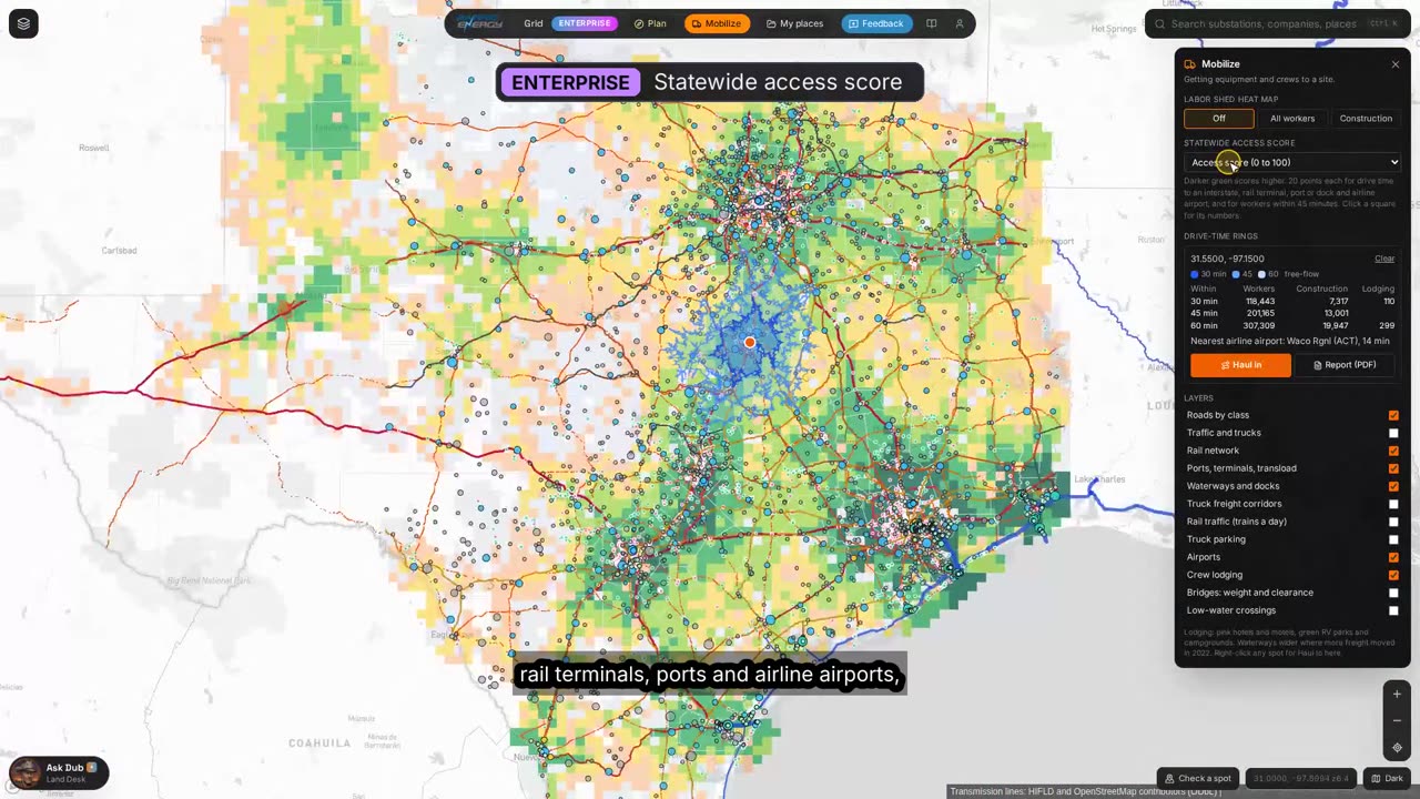
1:31 Statewide access score
Every 10 km square in Texas scored 0 to 100 on drive time to an interstate, a rail terminal, a port or dock and an airline airport, and on the workers within 45 minutes.
- Enterprise
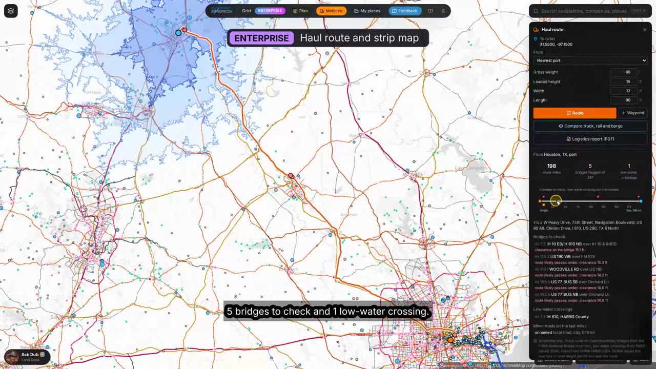
1:50 Haul route and strip map
A heavy-load truck route from the nearest port, terminal or a town, with posted and low-clearance bridges, low-water crossings and the minor roads on the last miles, laid out mile by mile.
- Enterprise
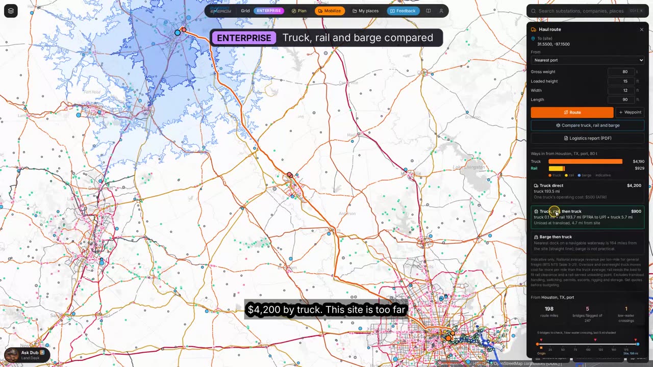
2:02 Truck, rail and barge compared
Truck direct against truck, rail and truck, and truck, barge and truck, with miles per leg and indicative linehaul costs from published national averages.
- Enterprise
2:15 Logistics report
One PDF with the map, the haul options, the route and its bridges, workforce, lodging and airports.
How a mobilization plan runs on Barrio Grid
Each step is a panel on the map or a tool your AI assistant can call through the connector.
- Pro
Open Mobilize
The map switches to a plain freight view with the roads, rail, ports, waterways, airports and lodging a logistics planner looks for first.
- Pro
Find the people
Turn on the labor shed, then pick the site for drive-time rings. Enterprise counts the workers, construction workers and lodging inside each ring.
- Enterprise
Screen the region
The access score ranks every 10 km square in Texas, so you can compare a site against the land around it before you commit.
- Enterprise
Route the heavy load
Right-click the site for Haul to here. The route avoids mapped height and weight limits and flags the bridges, low-water crossings and minor roads to check.
- Enterprise
Pick the mode
Compare truck, rail and barge with indicative linehaul costs, then confirm with carriers and the railroad. TxDMV sets every oversize or overweight permit route.
- Enterprise
Hand over the report
One PDF for the team: haul options, the route and its bridges, workforce, lodging and airports.
What you get back
Mobilize questions
Where does the data come from?
Public federal and state sources: FHWA highway and bridge records, the FRA rail network and train counts, US Army Corps transload facilities and docks, BTS ports and freight flows, FAA airports, TxGIO low-water crossings and Census LODES worker counts. Lodging is from OpenStreetMap. Routes and drive times run on OpenStreetMap roads.
Are the costs a quote?
No. They are national average linehaul rates per ton-mile from the Bureau of Transportation Statistics and the American Transportation Research Institute, for ranking options. They leave out handling, permits, escorts, rigging and storage. Get carrier quotes before you budget.
Does Mobilize give me the permit route for an oversize load?
No. It routes around mapped limits and flags bridges and crossings to check. TxDMV issues every oversize or overweight permit and sets the route.
How is the access score built?
Five parts of 20 points each, from the center of each 10 km square: drive minutes to the nearest interstate, rail terminal, port or dock and airline airport, and the number of workers living within 45 minutes.
Can my AI assistant use this?
Yes. Barrio Grid is an MCP connector: add https://grid.barrioenergy.com/mcp to Claude or any assistant that supports MCP and ask in plain English. The same tools run the map. Setup is on the API and MCP page.
Open the map and switch on Mobilize.
Mobilize layers are on Pro: $499 a month, first month $249. The haul planner, access score and report are on Enterprise.