
Find the water under the land before you buy it.
Barrio Grid maps every Texas aquifer, 857,000 cleaned state well records and the rules of each groundwater district. It proposes a supply well beside the real wells it is built from, draws a geologic cross section from the state's groundwater models, and puts it all in a water report for the site.
How to use every water tool
Each chapter of the video above, in the order you would use it. Click a chapter to jump to it.
- Free
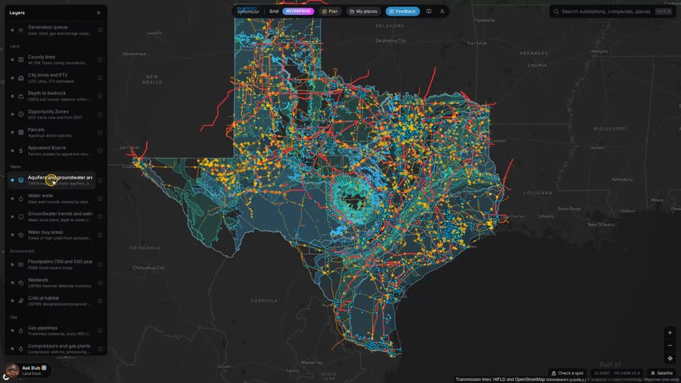
0:04 Aquifers
Every major and minor aquifer in Texas, where it outcrops and where it runs underground.
- Free
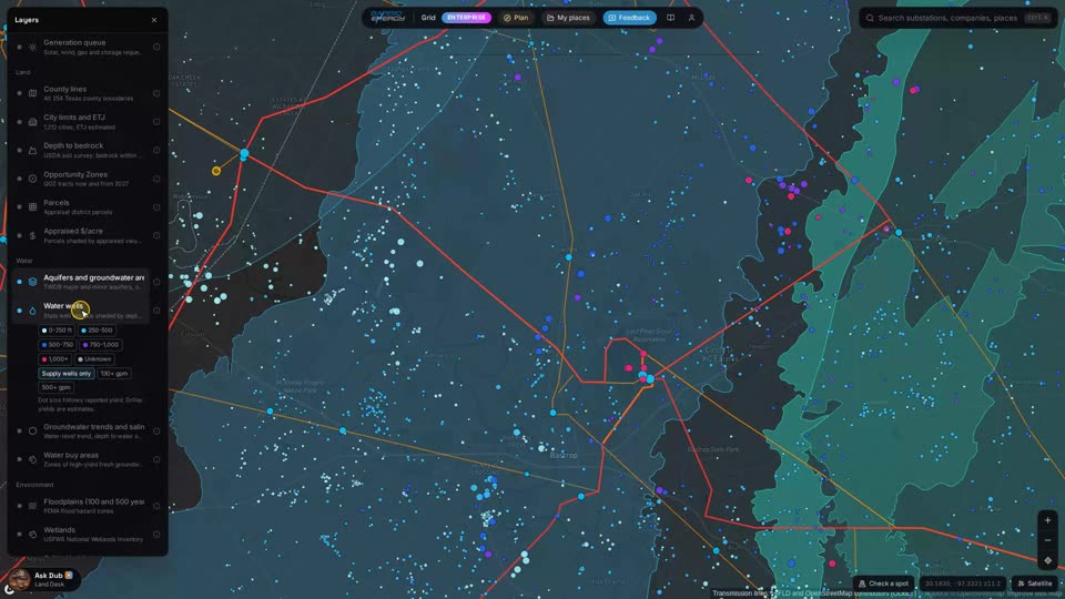
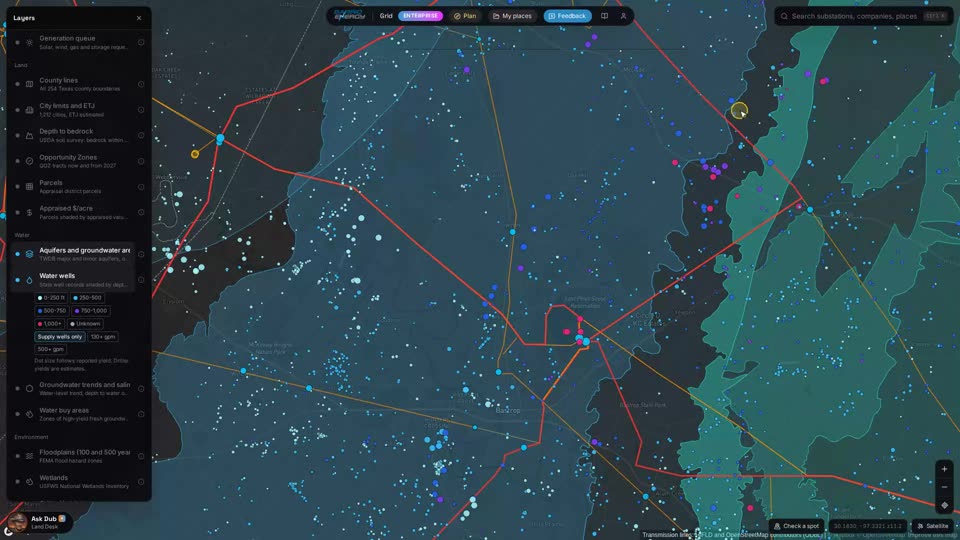
0:18 Water wells
857,000 cleaned state well records on the map, shaded by depth.
- Free
0:28 Spot card: aquifers and district
Check any spot for the aquifers under it and the groundwater conservation district it sits in.
- Pro
0:39 District rules
The district's own rules with page numbers: exempt wells, spacing, and how much you can pump per acre.
- Pro
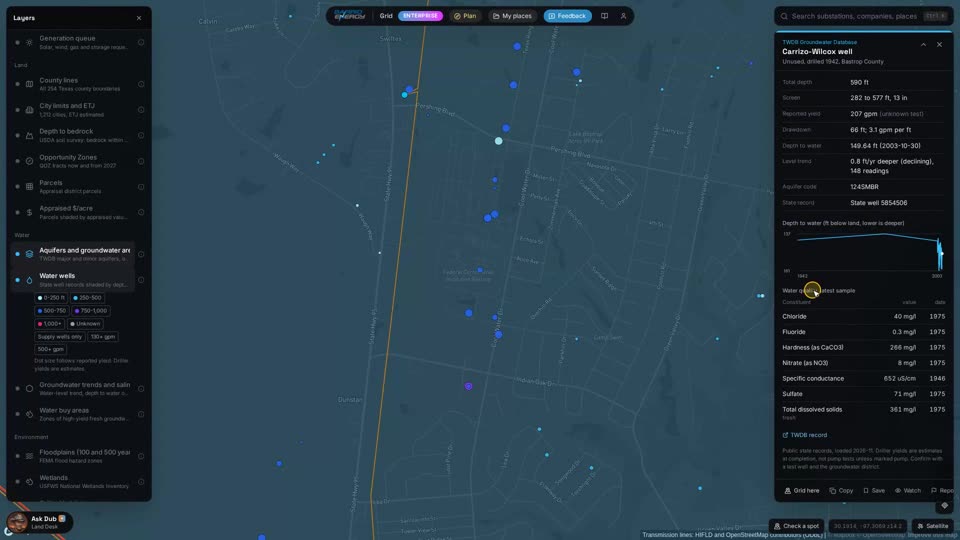
0:49 Well card
Click a well for its depth, screened interval, reported yield, water levels over the years and its water chemistry.
- Pro
1:04 Trends and salinity
Where water levels are dropping and where the water turns salty, by area.
- Enterprise
1:17 Water buy areas
The best groundwater graded A, B and C, drawn along the aquifer belts.
- Enterprise
1:26 Plan a supply well
Ask Dub for a well sized to your demand. It proposes one and draws it beside the real wells it is built from, so you can check the sand yourself.
- Enterprise
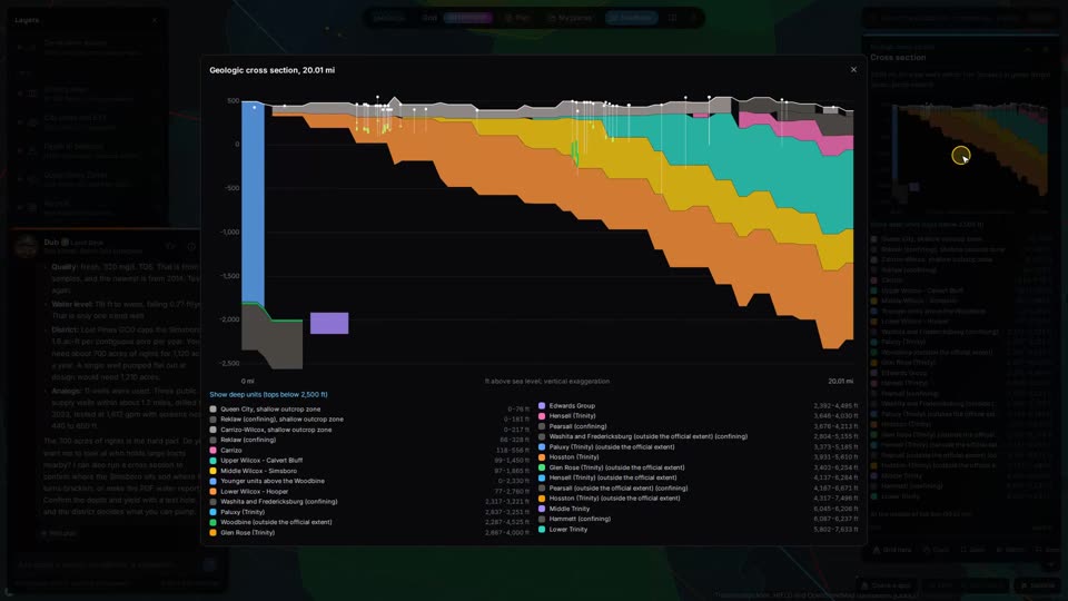
1:54 Geologic cross section
Draw a line and get the formations under it from the state's groundwater availability models, with every well along the line.
- Enterprise
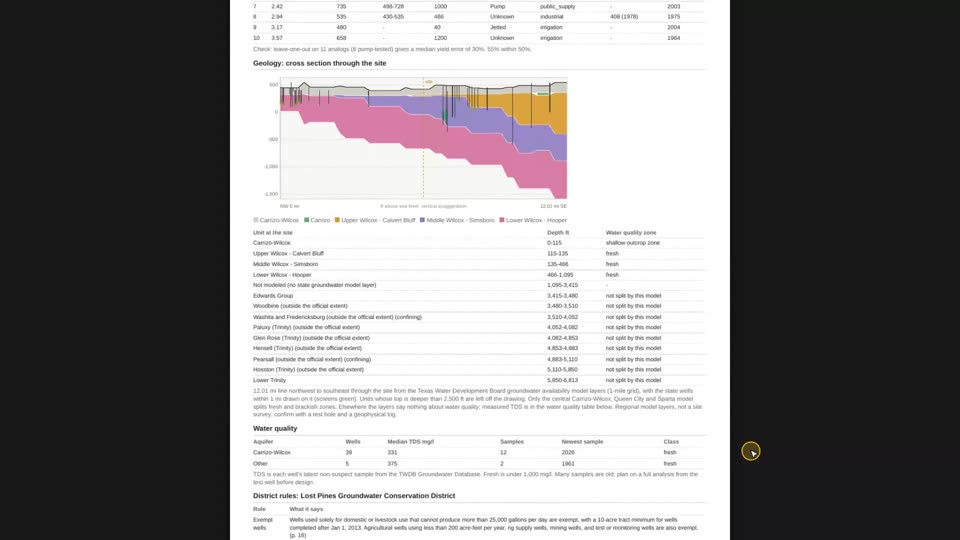
2:14 Water report
A PDF for the site: the geology, a cross section, the nearest good water, water quality and the district's rules.
How a water screen runs on Barrio Grid
Each step is a tool your AI assistant can call through the connector, or a panel on the map.
- Free
Ask Dub in plain English
Describe the site and how much water you need. Dub, the map's chat landman, names the aquifers under it, the groundwater district and the wells nearby.
- Pro
Read the rules before you drill
The district's exempt-well, spacing and production limits with the page they come from, so the permit question is answered before the land question.
- Pro
Check the wells that are already there
Yields, depths, water levels over time and chemistry from the wells around the site, and how many wells your demand would take.
- Enterprise
Find where the water is good
Buy areas grade the best groundwater A, B and C along the aquifer belts, so you can screen land by water before anything else.
- Enterprise
Plan the well and see the rock
A proposed supply well drawn beside the real wells it rests on, and a cross section from the state's groundwater models along any line you draw.
- Enterprise
Hand over the report
One PDF for the site with the geology, the cross section, the nearest good water, water quality and the district's rules. Confirm it with a test well and the district.
What you get back
Water questions
Where does the well data come from?
From the Texas Water Development Board's state well records: the Groundwater Database and the Submitted Drillers Reports. We clean and merge them into 857,000 wells and tie each one to the formation it produces from where the records allow.
Where do the district rules come from?
From each groundwater conservation district's own published rules. The card quotes the rule and the page it is on, so you can check the source. Rules change, so confirm with the district before you file.
How is the cross section built?
From the Texas Water Development Board's groundwater availability models, resampled to a one-mile grid, with the wells along your line drawn on top. It is a screening view: the models are regional, so a test well is what tells you what is under a specific tract.
Does Barrio Grid tell me how much water I can pump?
It shows what nearby wells report and what the district allows, and Dub can size a well plan to your demand from those wells. It does not replace a hydrogeologist, a test well or the district's permit.
Can my AI assistant use this?
Yes. Barrio Grid is an MCP connector: add https://grid.barrioenergy.com/mcp to Claude or any assistant that supports MCP and ask in plain English. The same tools run the map. Setup is on the API and MCP page.
Start with the aquifers. They are free.
20 calls a day and the map, no card. Pro is $499 a month, first month $249.